Green Network - walk along the Tolka to the sea
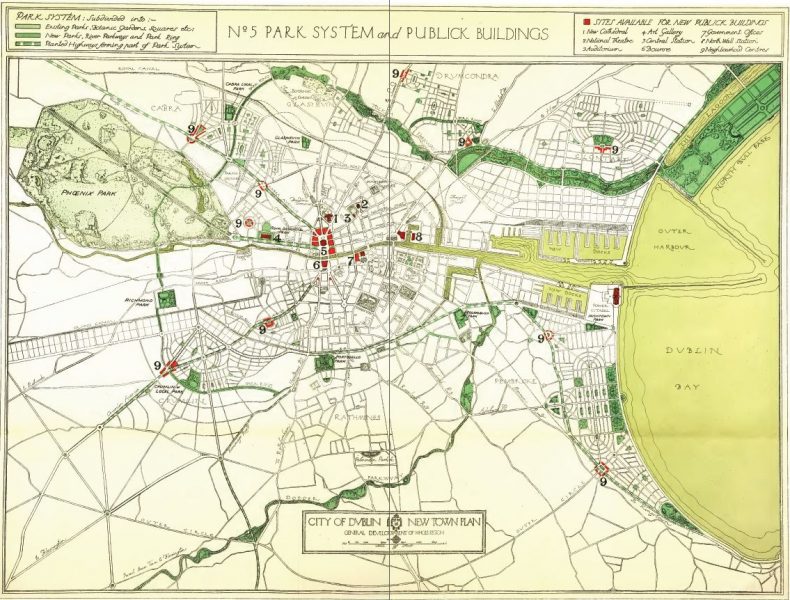
1922 - Abercrombie and Kelly - Dublin of the Future - The New Town Plan
Proposed the Tolka Parkway from the Glasnevin bridge to the sea:

1991 - ONeill - Environmental Development Strategy Drumcondra and Districts Final Report
"A walkway could be extended from Griffitb Park, at water level, to the public space at Botanic Avenue/Drumcondra Road. It is proposed to continue this walkway along the river east of the Drumcondra Road, parallel to the Richmond Road. The walkway would continue on the south bank of the river, at the back of Holy Cross College."
2003 - DCC - Drumcondra - development and open space strategy

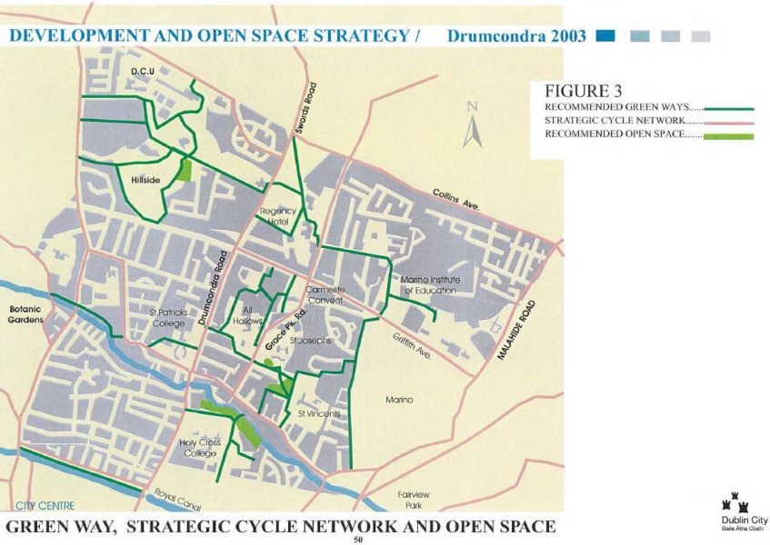
"A significant addition to the green way network is the provision of a pedestrian and cycle bridge over the River Tolka from the proposed Park to Richmond Road in the north"
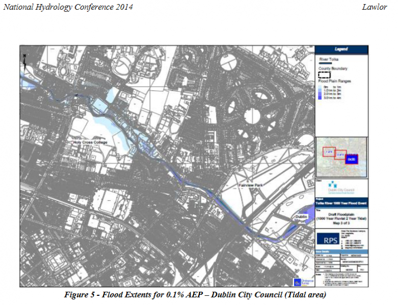
2014 - Summary of the flood risk at Tolka Park and Clonliffe - due to tide and river flow
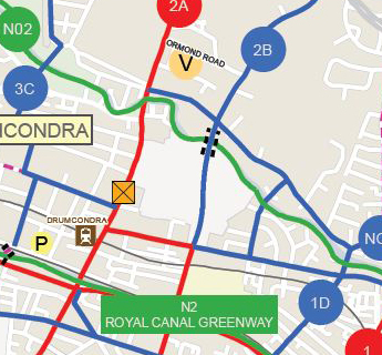
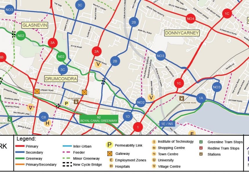
2014 - NTA - Proposed Cycle Network Dublin - Cycle paths and greenways
Proposes the greenway N02 along the Tolka River, and the cycle path 2B along Holy Cross Avenue and across the Tolka River near Tolka Park stadium.

2016 - 2022 - Dublin City Development Plan
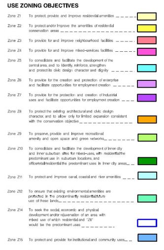
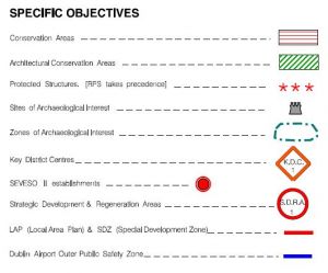
According to this plan the the lands fall either in
- Z09 - to preserve, provide and improve recreational amenity and open space and green networks and
- Z12 - to ensure that existing environmental amenities are protected in the predominantly residential future of these lands
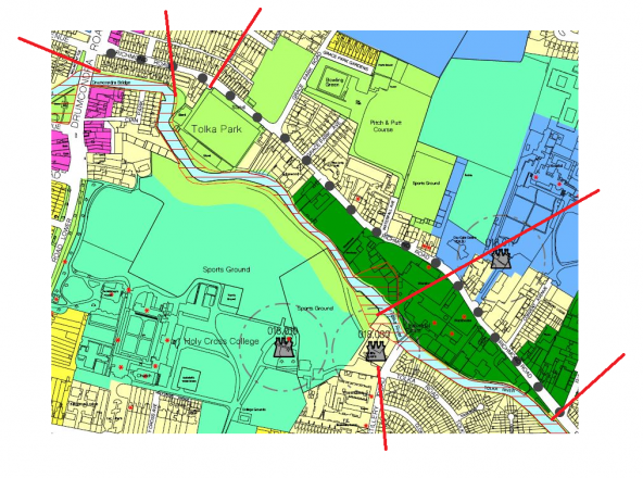
Note that the Z09 area shown implies a green network amenity stretching from the north eastern tip of Tolka Park Stadium AND from the northern banks of the river at the Frank Flood bridge to the West to the bridge on Distillery Rd.
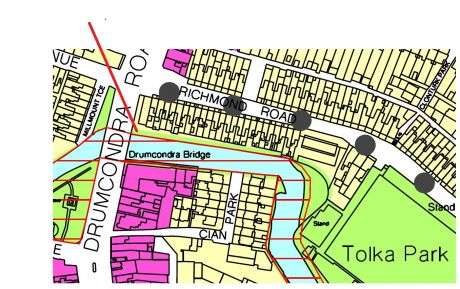
Also note that the gardens along the north banks of the Tolka next to Frank Flood (Drumcondra) Bridge seem to have been extended without planning permission - access is currently blocked along the Tolka at the point shown:
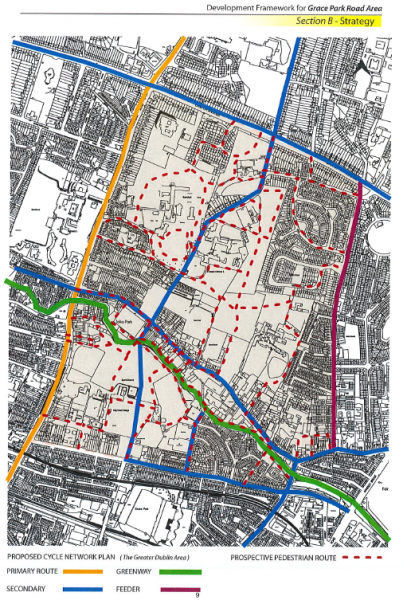
2017 - DCC - Grace Park - local development plan
2019 - North City Walk - GAA to Glasnevin and back
Group Submission to the GAA on the Masterplan for the Holy Cross College Lands at Clonliffe
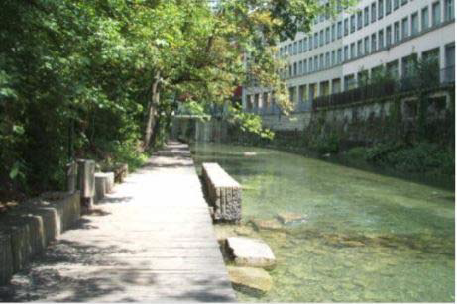
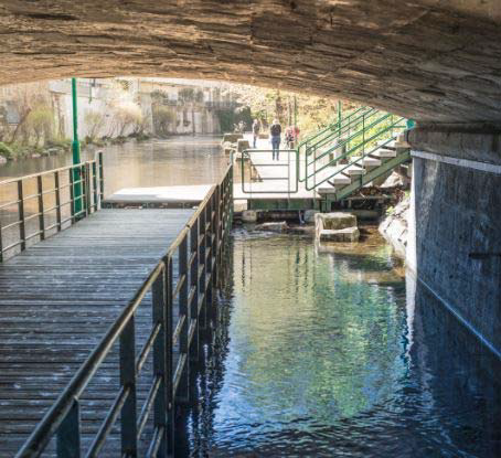
2019 - Tolka river walk way - from Fairview to the Botanics and beyond
A proposal to open a green walkway along river Tolka with reference to the scheme along the Limmat river in Zurich, Switzerland was made independently by local residents in Drumcondra in 2019. This scheme uses the novel solution of along river and under bridge "floodable" stone pathways to build a path in built-up areas.
2021 - SHD - Hines -Masterplan
The masterplan makes much of the green network into which the development seeks to build:
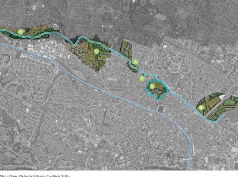
(picture from the masterplan)
- Tolka Valley Park
- National Botanic Gardens
- Griffith Park
- Clonlife Road
- Our Lady’s Park
- Fairview Park
Does offer some potential relief:
"Connectivity to a potential future North-South green corridor linking Holycross Avenue to Richmond Road connecting the appealing open spaces to the surrounding area has been allowed for"
This is most welcome, but can this "aspiration" be made concrete/enforcable before planning is granted?
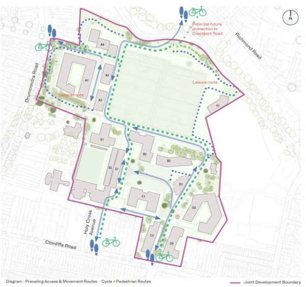
What's missing in the Masterplan
2021 - What's missing in the Masterplan
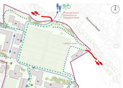
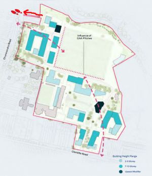
- the second pictures shows an extra entrance/exit in the north eastern corner (from Hines' original document) - this tongue of land does not appear in the diagram on the left (from the masterplan
- this would provide an ideal peaceful footpath nearer to the Frank Flood bridge linked to the Green Network towards Our Lady's Park and Griffith Park
- The masterplan should include a binding provision for these extra entrances
Concrete legally binding commitment to these pathways
